Division of Hydrography, Oceanography and Marine Cartography

قسم الهدروغرافية و علم المحيطات و الخرائطية البحرية

Hydrography

Hydrography

Hydrography is defined as a science dedicated to the measurement and description of the physical elements of oceans, seas, coastal areas, lakes and rivers as well as the prediction of their evolution over time (International Hydrographic Organization (IHO)). The Division of Hydrography, Oceanography and Cartography (DHOC), acting as a National Hydrographic Service in Morocco, mainly collects and compiles hydrographic data to publish nautical documents and charts, in order to ensure the safety of navigation. furthermore, hydrographic data may be used in many other applications.

 

Hydrographie

Behind every nautical chart, a compilation of hydrographic surveys carried out to provide all the necessary data for updating nautical information in national waters, which contributes to the national development by enhancing the international and coastal commercial exchanges.As well, the DHOC oversees the development of hydrography and its related fields in Morocco within a close cooperation with its national partners in the National Committee of Coordination in Hydrography, Oceanography and Cartography fields (CNCHOC). The DHOC staff work permanently to ensure the compliance of hydrographic data collected in national waters with the quality and uncertainty requirements. In this same framework, the DHOC develops a National database of Hydro-Spatial Data, to improve environment protection and resources management and exploitation.Hydrography gathers many scientific and technical fields; a hydrographic survey may include several activities and operations.

Bathymétrie

Bathymetry

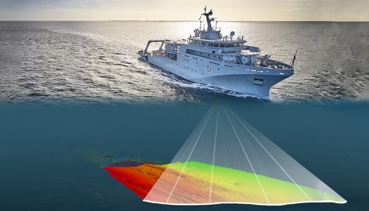
Bathymetry is the description of submerged lands configuration; bathymetric surveys are carried out on dedicated vessels which contains a set of high technology instruments and sensors (Echosounders, Motion Reference Units, Sound Velocity Probes, GNSS System…). The centimetric level precision measured depths are used to produce a Digital Terrain Model (DTM), which provides a high-resolution 3D representation of the seabed.

The bathymetric description of an area is one of the decision-making elements to meet the needs of offshore activities, it supports all the activities related to the sea (exploitation of marine resources, positioning offshore platforms, coastal management and protection, dredging operations, submarine cables…).

The DHOC teams measure permanently the depths of Moroccan waters to ensure a better knowledge of the national oceans. The acquired data on board DHOC’s vessels is carefully processed and validated to provide a quality product which meets the international standards.

Description du trait de côte

Description of the coastline

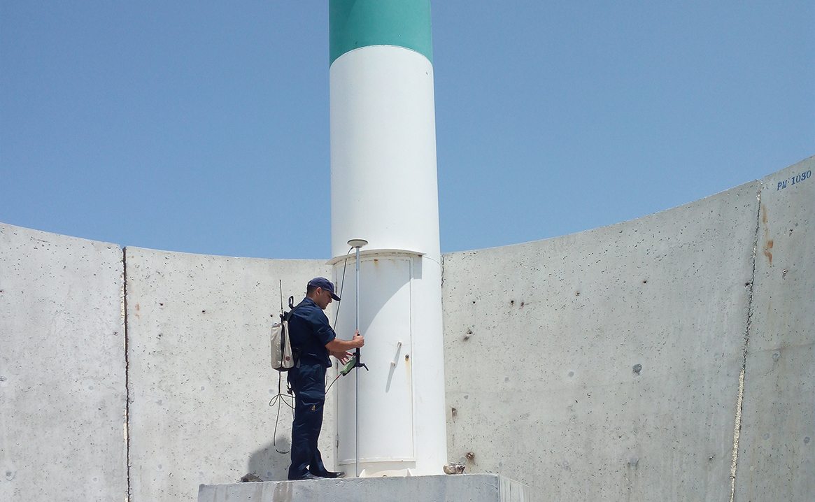
The DHOC staff measures the coastline positions using a high precise technology as the carrier phase GNSS positioning method. The purpose of the coastline description is to provide a faithful and well-detailed description of the shape of this feature to be able to represent it on nautical charts. This is generally done over the entire land-sea interface of interest through surveys with an accuracy around 5cm.

Review of notable landmarks and aids to navigation

The description of all notable navigation landmarks visible to mariners, whether they are directly on the coast or further out in the land, is essential in nautical charts. Position as well as the characteristics and sectors of navigation aids are noted so that they can be plotted on nautical charts.

img3

Description of the seabed nature

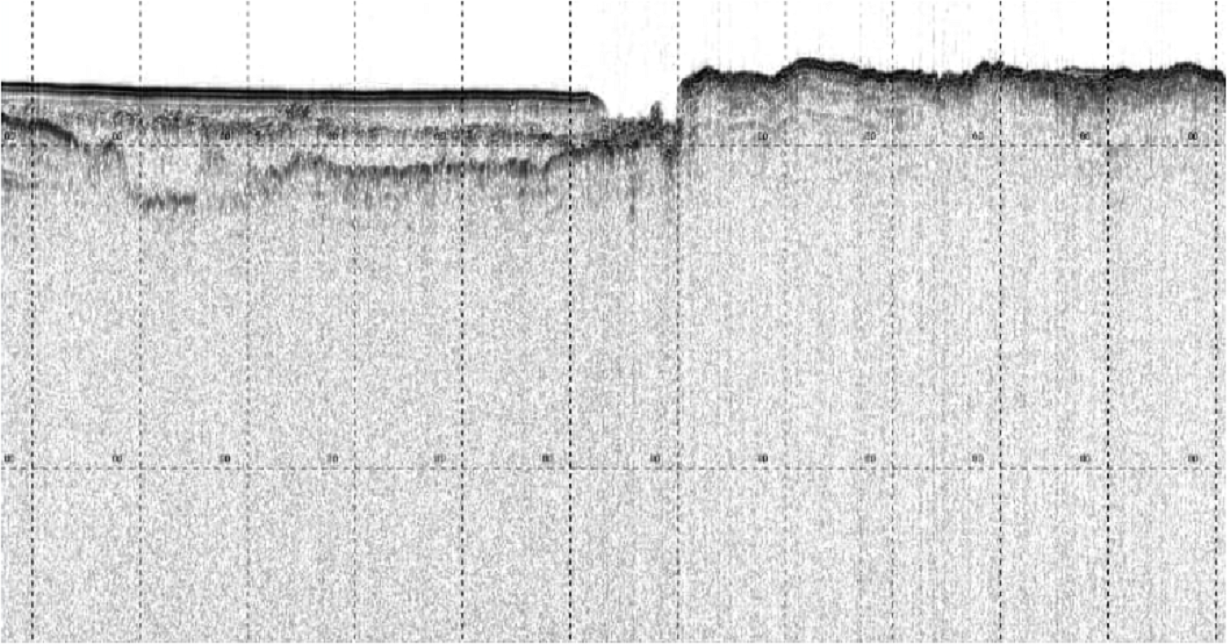
The nature of the seabed is a precious information for offshore activities, sailors need to know how the bottom type is in shallow waters and anchorage areas. Moreover, offshore platforms, underwater pipelines and many other marine activities are bottom type and sediments thickness dependent. Those information are determined through sediments sampling using a dedicated grab or by coring. Very low frequency echosounders (sub-bottom profiler) are also used to determine the different layers that compose the substratum.

 Description de la nature des fonds marins