
Division of Hydrography, Oceanography and Marine Cartography
قسم الهدروغرافية و علم المحيطات و الخرائطية البحرية
Division of Hydrography, Oceanography and Marine Cartography
قسم الهدروغرافية و علم المحيطات و الخرائطية البحرية
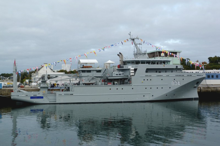
As a part of the capacity building plan of the Royal Moroccan Navy, related to the fields of hydrography, oceanography and cartography, and in order to carry out hydro-oceanographic surveys throughout the moroccan coasts, the Royal Moroccan Navy commissioned in October 2018, a new 72-metre Hydro-Oceanographic Multi-Mission Ship (BHO2M), whose construction was entrusted to the PIRIOU Shipyard in France.
Indeed, the BHO2M is a recent generation scientific vessel equipped with systems suitable for surveys, according to the standards of the International Hydrographic Organization (IHO).
Moreover, this vessel is characterized by high modularity, offers the possibility of carrying out many specific missions, The BHO2M is capable of carrying out long operations at sea, mainly hydrographic and oceanographic ones. Surveying, data acquisition and processing, scientific sampling and associated analysis, could be a few examples. Equipped with a gondola where the acoustic bases of scientific equipment are placed, and in particular those of the two Multibeam Echosounders, this vessel is the most efficient of its generation in terms of acoustics. It will also be able to carry out this work at high speed while operating in rough seas. The ship will also be able to meet the operational needs of the authorities concerned with maritime surveillance, humanitarian assistance, the deployment of special forces or divers, sea rescue and environmental protection.
A large rear deck that can accommodate containers or other equipment:
• Handling means to embark and use specialized equipment;
• Two operational VERTREP zones;
• Facilities dedicated to specific missions, with the possibility of welcoming scientists on board.